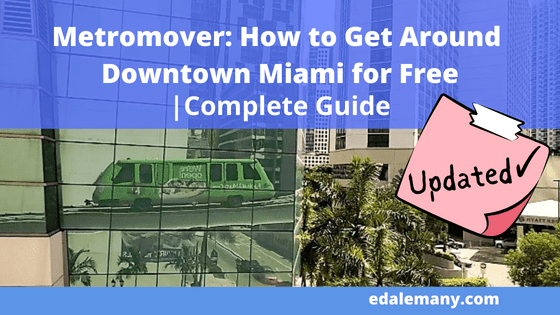
The Metromover allows you to get around Downtown Miami for free along its 4.4 miles (7.1 km) itinerary. My Complete and Updadted Guide will answer most questions you might have.
Like; Is it really for free? Where can I catch it? How does it work? Where does it go? and many others.
Keep reading to get the most out of this guide with photos, videos, maps, and free downloads.

Contents / Contenido
Miami Public Transportation
The Grand Miami Public Transportation System, although it still needs improvement, it has shown progress in the last 5 to 10 years. Offering four ways of transport which are:
- Metrobuses
- Metrorail
- Metromover
- Trolleys
In a previous post, I explained how the system works in general, answering some of the frequent questions, and even providing different transportation alternatives from the Miami International Airport to Miami Beach, Downtown, and surrounding neighborhoods.
I suggest you read this article here for more valuable information.
Metrobuses and Metrorail
What we call “Metrobuses” are the local buses that circulate through the city.
“Metrorail” is the equivalent of the metro, subway, the underground, or the tube, as people call it in other cities. The main difference here is that the system is overhead instead of underground.
While Metrobuses and Metrorail are paid systems (more about the price and how to pay, here), two of the four options are free.
They are the Metromover and the Trolleys.
Yes, you’re reading correctly! They are free!

Metrobus

Metrorail

Trolley

Metromover
Trolleys
The Trolleys is a system with several itineraries, and there’s a lot to cover. Therefore I will be posting several articles, one for each route, in the near future. Stay tuned for that!
Metromover
I remember when I was a child; I used to fantasize about traveling in a city through an elevated track, going through buildings, watching parks, people, and traffic from above, in automated cars with no driver, and self-opening sliding doors. Did you ever fantasize about that too?
Well, whether you did or not, that is possible to do in Downtown Miami and best of all, it is absolutely free.
Metromover Discription
The Metromover, or the mover as we also call it here, is an electric and automated system that travels high above ground around Downtown Miami and its surroundings.
Its three itineraries connect with several places of interest, parks, shopping centers, attractions, landmarks, bars, restaurants, and places to stroll and relax.
How Does It Works?
The elevated system is electrical and automated. That means each car is operated by a central computer system, pretty much like an elevator, only that instead of traveling vertically, it does so horizontally. That’s why you will not see a driver.
The stops and frequency between cars are also programmed. That’s why you won’t need to press a button like in an elevator to stop the car at each station.
Each car is equipped with an intercom to contact a real person in case of emergency, and cameras to monitor the interior of each car, as well.
Wi-Fi and air conditioning are also available, and all cars are suited to accommodate passengers in a wheelchair. Each car can carry about 90 passengers.
Inside, a very easy-to-understand itinerary map placed near the ceiling will show you all the stops. A recording will announce that the car will start moving, so you can hold on for your safety, as well as the name of the next stop.

Intercom

Camera

Camera

Number to report an incident

Itinerary Map

Is Metromover Safe to Ride?
Overall it is safe. But I wouldn’t suggest riding it at night, just in case. My suggestion to the City of Miami Transportation Department is to place security guards in each car and station, mainly at dusk.
I even suggest you send a message to the Transportation Department requesting security guards, or any other suggestion or problem you may have. Here’s the contact information: City of Miami Transportation Department / Suggestions.
I also suggest being aware of your surroundings and the people around you, not only on the Metromover but at all times.
If you ever feel unsafe, walk away, wait for the next car, or just get off at the next station and wait for another vehicle. Especially if you’re traveling alone, join a group of people.
One more tip to consider, and this is a good one even when you visit any part of the world, don’t stare at people you don’t know. They might feel offended, and that might lead to a confrontation.
The same care you have to take with taking photos of people who may attract your attention, you must ask gently for permission or do it with great dissimulation since many of them may feel offended or for many reasons, even religious, they do not like to be taken photos and this could lead to a confrontation.
How Much Does It Cost?
No need to pay, no ticket to buy! Nothing, Nada!
How to Access the Stations?
All Metromover Stations are accessible from the ground floor via elevator, escalators, and stairs. A map of the Loops with stations and surroundings is displayed on all platforms on big billboards.
Once you reach the station on a higher level, make sure you don’t get close to the yellow tiles on the floor indicating the edge of the platform until the car has arrived at the station.
A bell sound and announcement will indicate a car is approaching. Make sure to read the signs on the front of the car, indicating the direction the car is going (Omni, Brickell or Inner Loop) so you take the correct one.
Once the car has stopped and has opened the doors, allow passengers to leave the train before boarding. Doing so not only is expected by the regular users but it is also seen as good manners and it’s also safer for everyone so people don’t step on each other.

Elevator to the station with wheelchair access

Wheelchair Access Sign

Poster with itinerary map and luminous sign showing direction of train

Yellow tiles indicating platform edge

Light up sign showing direction of train

Daily Users
Something very important to remember is that Metromover is a public transport service which is used by a wide variety of people. Therefore, you should know you will meet people of all kinds.
That is why, it’s important that you keep an open mind and positive attitude since mixing up with the locals and seeing how they live and their customs, is part of the learning and experience that traveling to different places gives us.
It is also important to be attentive to what happens around you and the items you carry with you, such as cameras, bags, wallets, sunglasses, hats, umbrellas, and others, so as not to forget them when you leave the vehicle.
Travel is fatal to prejudice, bigotry, and narrow-mindedness
Schedule and Frequency
Starting May 2, 2021, service hours are from 5 am to 12 midnight, seven days a week.
During peak hours, cars run every one and a half minutes, and every 3 minutes the rest of the time.
Loops
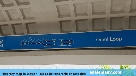
The meaning of loop here is; itinerary. So, the Metromover has three loops or itineraries and they are:
Inner Loop:
This one runs clockwise around Downtown, servicing eight stations located two blocks away from each other. Miami Avenue Station is the only station served by the Inner Loop and not by the other two loops.
This loop was the first one to start operations on April 17, 1986.
Omni Loop:
This one runs counterclockwise around Downtown, extending the service to 6 more stations north of Downtown ending in the School Board Station. This loop, along with the Brickell Loop, started operations on May 26, 1994.
Brickell Loop:
This loop also runs counterclockwise around Downtown, extending the service to 6 other stations ending in the Financial Center on Brickell Area, south of Downtown.
All this might seem a bit complicated at first, but once you look at the map, it will all make sense.
Connection with Metrorail
There are two stations connecting with Metrorail. They are:
- Government Center Station – Reached by all 3 loops
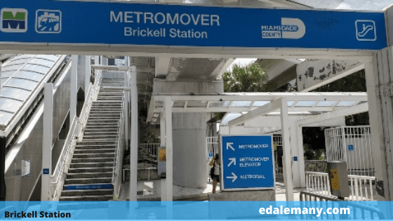
- Brickell Station – Reached by Brickell loop, only

Government Center Station

Brickell Station
Connection with Trolleys
- OMNI / Adrienne Arsht Center Station – Connects with: Biscayne Route and Wyndwood Route
- Bayfront Park Station – Connects with: Biscayne Route and Coral Way Route
- Miami Avenue Station – Connects with: Coral Way Route
- Brickell City Center Station – Connects with: Biscayne Route and Brickell Route
- Brickell Station – Connects with: Biscayne Route, Coral Way Route, and Brickell Route
- Financial Center Station – Connects with: Biscayne Route, Coral Way Route, and Brickell Route
Public Restrooms
An important issue that primarily concerns international tourists is the availability of public toilets or restrooms, as we call them here.
Here is a list of places where you can find public restrooms near the Metromover loops.
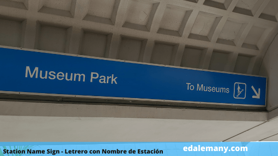
🟢Museum Park Station – At the park between the two museums, and in the cafeteria
🟢Park West Station – At the Maurice Ferré Park, a block from the station on Biscayne Blvd.
🟢College North Station – At the Miami Dade College, half block away from the station, next to the cafeteria
🟢College Bayside Station – At Bayside Marketplace
🟢Government Center Station – Next to the restaurant
🟢Bayfront Park Station – At the park, across Biscayne Blvd
🟢Fifth Street Station – In Riverside
🟢Eighth Street Station – Inside Brickell City Center mall
On the other hand, if you find yourself away from any of these places, in general, most restaurants and hotels have no problem letting you use their restrooms. Just remember to ask permission in a nice way.
Museum Park Station – At the park between the two museums and in the cafeteria.
There’s also a water fountain and bottle refill.


College North Station – Half a block from the station is the Miami Dade College.
There, you will find a cafeteria where you can rest and get some snacks, as well as use the restrooms.


Next to the College North station, there’s also a stand for free covid testing.

Government Center Station – This station is considered the main one because apart from being the biggest one, it also connects to the Metrorail, and it’s where the customer service office is located.
Here you can purchase the Easy Card which is good for all type of public transportation.
The restrooms are located next to the restaurant.


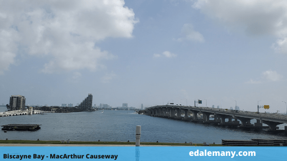
Where Does It Go?
The system covers a total distance of 4.4 miles (7.1 km), servicing 21 stations that connect with all major government and office buildings, residential buildings, shopping centers, parks, hotels, and attractions in the area.
Places of Interest
From North to South, these are the places of interest you will encounter in the itineraries:
2 Malls
🔴10 – Bayside Marketplace – College Bayside Station
🔴22 – Brickell City Center – Eighth Street Station
2 Commercial Areas
🔴14 – Downtown/Flagler Street – Government Center, Bayfront Park and Miami Avenue Stations
🔴23 – Brickell Village – Tenth Street Promenade Station
3 Parks
🔴7 – Maurice A Ferré Park – Eleventh Street Station
🔴15 – Bayfront Park – Bayfront Park Station
🔴19 – Brickell Park – Fifth Street Station
27 Places of Interest
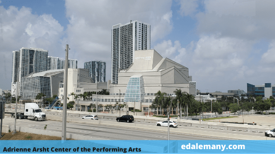
🔹 Omni/Adrienne Arsht Center Station
🔴1 – Trinity Cathedral
🔴2 – Centro Cultural Español (Spanish Cultural Center), home of Microteatro
🔴3 – Adrienne Arsht Center for the Performing Arts
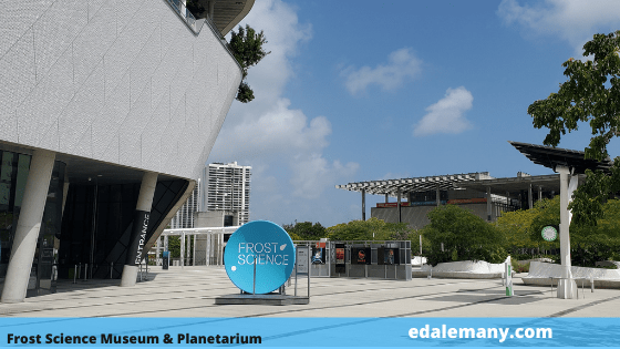
🔹 Museum Park Station
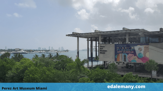
🔴4 – Frost Museum of Science
🔴5 – Pérez Art Museum Miami
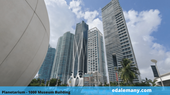
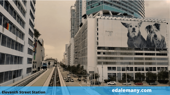
🔹 Eleventh Street Station
🔴6 – 1000 Museum Building – Iconic Building
🔴7 – Maurice A. Ferré Park
🔹 Park West Station
🔴8 – Freedom Tower / Torre de la Libertad – Museum and Historic Place
🔴9 – FTX Arena, also known as AAA Arena
🔹 Freedom Tower Station – Closed for improvements
🔹 College North Station
🔴10 – Miami Dade College
🔹 Government Center Station
🔴12 – HistoryMiami Museum
🔴13 – Main Public Library
🔴14 – Downtown / Flagler Street – Commercial Area
🔹 Miami Avenue Station
🔴14 – Downtown / Flagler Street – Commercial Area
🔹 Colleger Bayside Station
🔴10 – Miami Dade College
🔴11 – Bayside Marketplace – Shopping Center
🔹 Bayfront Park Station
🔴14 – Downtown / Flagler Street – Commercial Area
🔴15 – Bayfront Park
🔴16 – Southeast Financial Center Building – Iconic Building
🔴17 – Riverwalk
🔹 Fifth Street Station
🔴18 – Miami Circle – Historic Place
🔴19 – Brickell Park
🔴20 – First Miami Presbyterian Church – Church and Historic Place
🔴21 – Riverside – Riverfront Venue with entertainment and gastronomy
🔹 Eight Street Station
🔴22 – Brickell City Center – Mall
🔹 Tenth Street – Promenade Station
🔴23 – Brickell Village – Commercial Area
🔹 Brickell Station
🔴24 – Connection to Metrorail Station
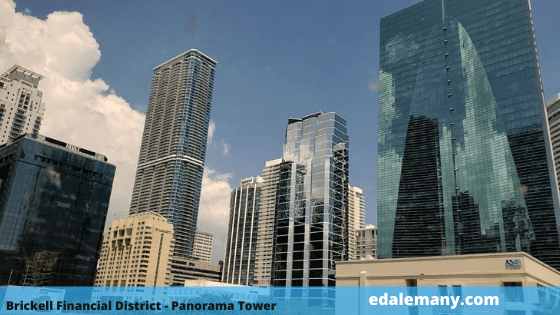
🔹 Financial District Station
🔴25 – Financial Center
🔴26 – Panorama Tower Building – Miami’s tallest building
🔴27 – Four Seasons Hotel Miami – Miami’s second tallest building

Photo Gallery
Click on the pictures to increase their size.

Estación Adrienne Arsht Center
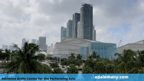
Adrienne Arsht Center
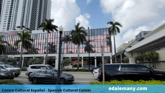
Centro Cultural Español
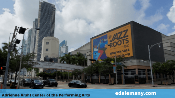
Adrienne Arsht Center
Bahía de Biscayne
Adrienne Arsht Center
Estación Museum Park
Letrero de Omni Loop
Museo de Arte
Planetario y Edificio 1000 Museum
Museo de Ciencia y Planetario
Estación Eleventh Street
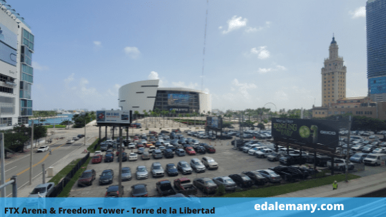
FTX Arena y Torre de la Libertad
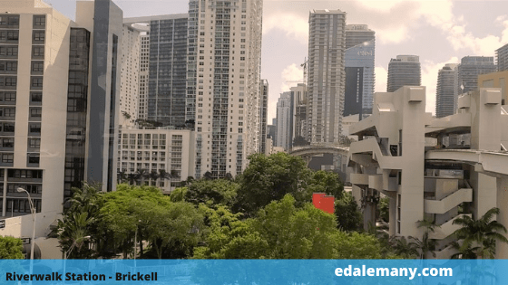
Estación Riverwalk
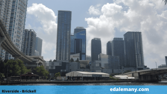
Riverside
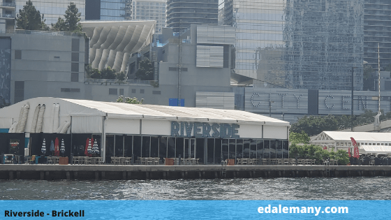
Riverside
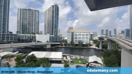
Estación Fifth Street
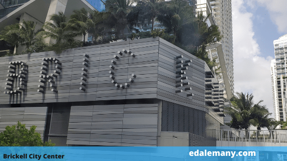
Brickell City Center
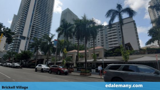
Brickell Village

Brickell Village
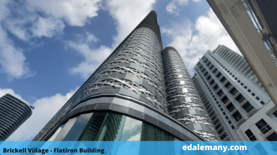
Brickell Village
Estación Brickell
Financial District – Torre Panorama
Videos
BRICKELL LOOP
OMNI LOOP


CONCLUSION
I sincerely hope you find this information of use, whether you are visiting or living in the Magic City.
I invite you to take this tour and tell me about your experience. Or, let me know of any information that you think it might be missing.
I would love to read your comment below, and want you to know that sharing the article with your friends and family, helps me get more traffic and reach more people through the internet.
Thanks for reading this far. It will be until my upcoming publication. I promise to return with the Trolleys’ itineraries soon.
Until then!
Ed Alemany
CONTINUE READING


Such a great info, Ed! Good Job!
I’m sincerely glad that you found this interesting. Appreciate your comment, Mau.
Thank you and please, share with the post in your social media! 😉
This is great information right here. In the past when I visited Miami I have to say that was the one thing that was slightly frustrating was where to park? When I lived in Chicago there was a tendency to get parking tickets when meters expired or accidentally Park in some place where you really shouldn’t be parking etc. So what you have shared here is vital information for someone to review before a trip to Miami. I know that I’m going to LOL find some good place to park in a hotel or whatever off the beaten path and after that just use public transportation and you have shared some keys and making that easier to do. Thank you Ed you have a good heart and you are respected by this guy right here.
Hi Mike! Thank you very much for taking the time to write your feedback. I’m very happy to see that someone will benefit from my writings!
I’m gonna recommend that you also read How to Get Around Miami using Public Transportation before you come to Miami next time. It will save you money and headaches! LOL 😉
Hello There. I found your blog using msn. This is an extremely well written article.
I’ll be sure to bookmark it and come back to read more of your useful information. Thanks for
the post. I will definitely comeback.
What kind of digicam was used? That is certainly
a great premium quality.